

Continuous global visibility
Reliable ULD location and status information across international routes.

Demonstration project - Aviation
SAT TRACE
Global, real-time tracking of Unit Load Devices using satellite connectivity and smart asset tags.

01 Mission
Thousands of Unit Load Devices are misplaced every year, creating delays, unnecessary repositioning and avoidable financial loss.
Existing tracking solutions depend largely on terrestrial communication networks and provide limited coverage.
SAT TRACE combines satellite connectivity with smart asset tags to deliver reliable tracking throughout the operational lifecycle—even where no mobile network is available.
The service gives airlines and ground handlers the information needed to monitor equipment, improve fleet utilisation and make faster operational decisions.
02 Users
SAT TRACE is designed for airlines, ground handling companies and organisations responsible for managing ULD fleets. These users require reliable asset visibility to reduce losses, improve fleet utilisation and support efficient operations across international air cargo networks.
The service combines global connectivity, secure data handling and simple web-based monitoring without adding unnecessary complexity to existing aviation workflows. The initial target market is Germany, followed by Europe and the global aviation industry.
The six priorities below define what users need from SAT TRACE in daily operations.
Reliable ULD location and status information across international routes.
Tracking remains available where cellular connectivity is limited or unavailable.
Misplaced assets can be identified and recovered more quickly.
Reduced leasing, replacement and repositioning requirements.
Better use of available ULD inventory across the network.
Easy workflow integration with secure web monitoring and reporting.
03 System concept
A smart tracking device follows each ULD from location and status detection to secure web access. Data uses terrestrial connectivity where available and satellite communication where cellular coverage is unavailable.
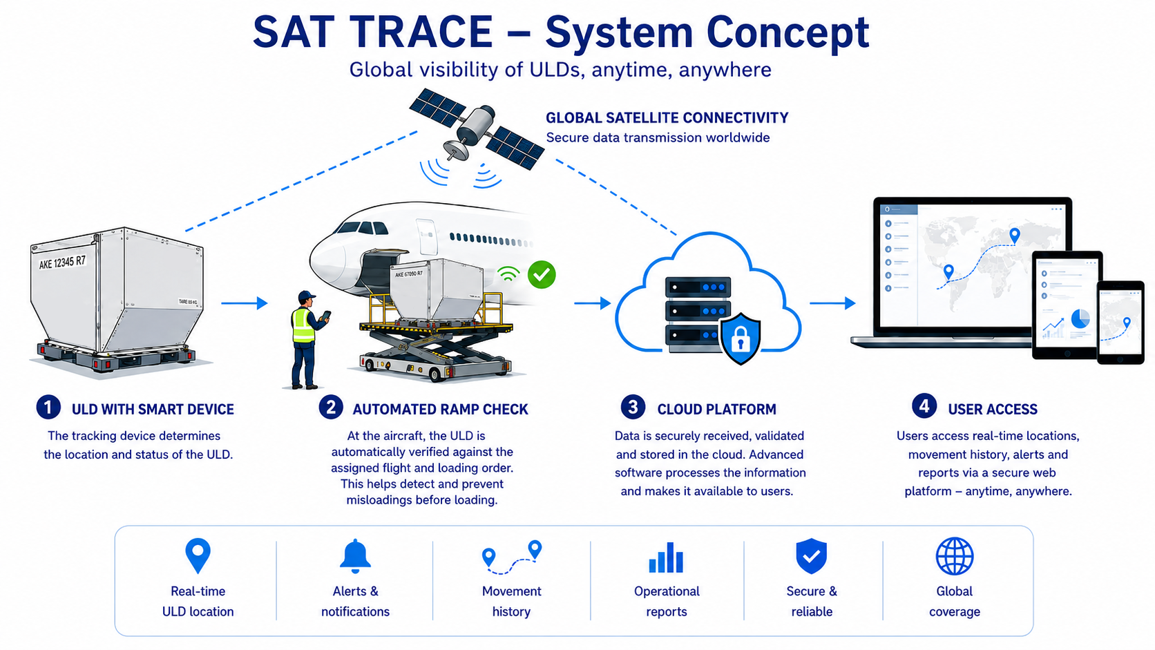
A compact tracking device is attached to the ULD.
The device detects the ULD location, movement and status.
Data travels through terrestrial connectivity or satellite communication.
Information is received, validated and processed securely.
Authorised users access clear operational information through the web platform.
04 Space added value
Satellite communication is the primary space asset in SAT TRACE. It extends tracking beyond terrestrial cellular coverage and supports resilient visibility across international and remote operations.
05 Current status
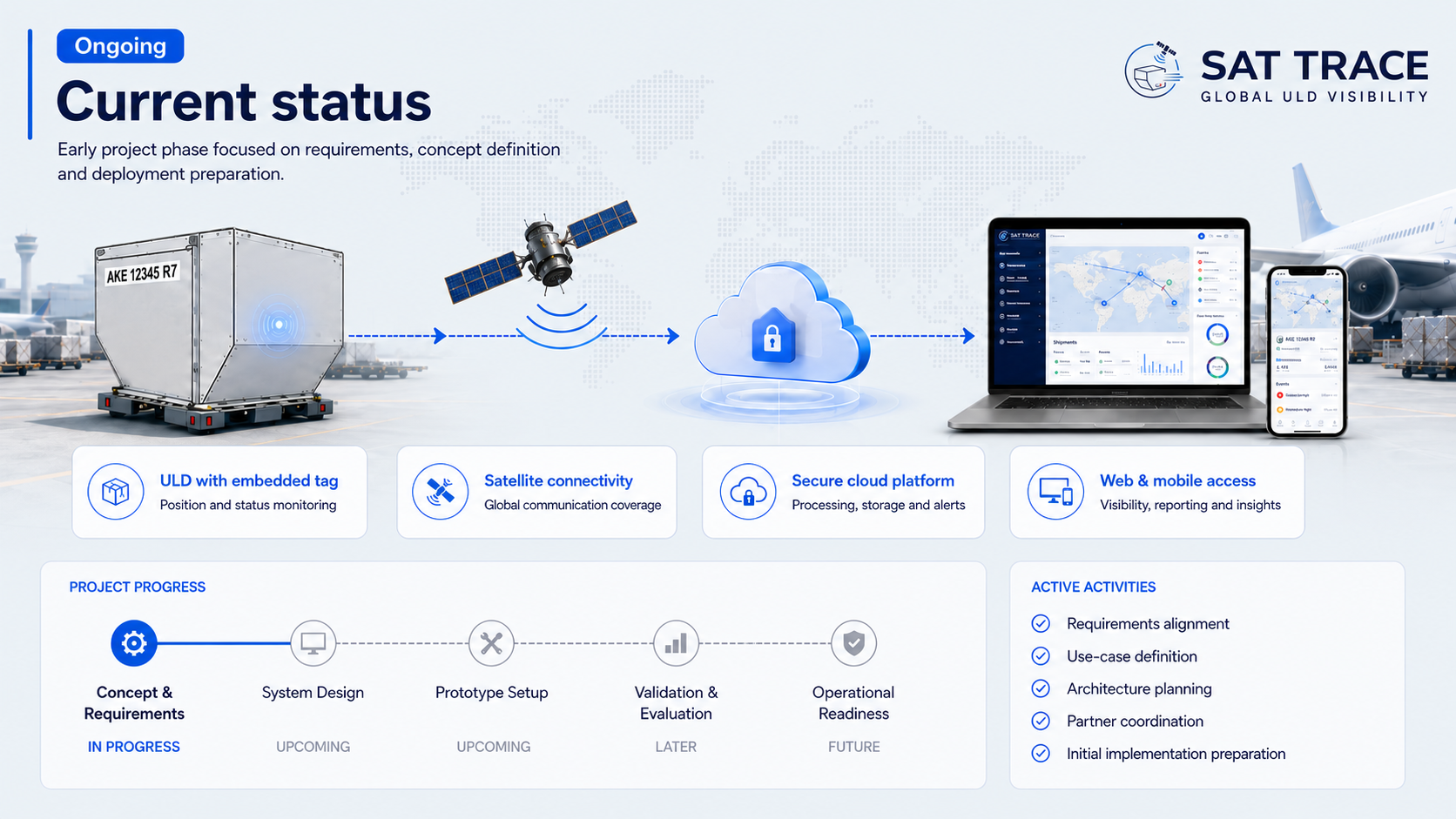
SAT TRACE develops and validates an operational service that integrates satellite communication, Internet of Things technologies and aviation workflows into a scalable tracking solution.
Technical performance, operational benefits and commercial potential are evaluated with representative users from airlines and ground handling organisations.
06 About
Prime contractor · Germany

IRPD GmbH is the prime contractor behind SAT TRACE, coordinating the development of a satellite-enabled service for reliable Unit Load Device visibility across global air cargo operations.
The company connects applied research, technology development and market-oriented project delivery from its headquarters in Bad Aibling, Germany.
Visit IRPD GmbH